

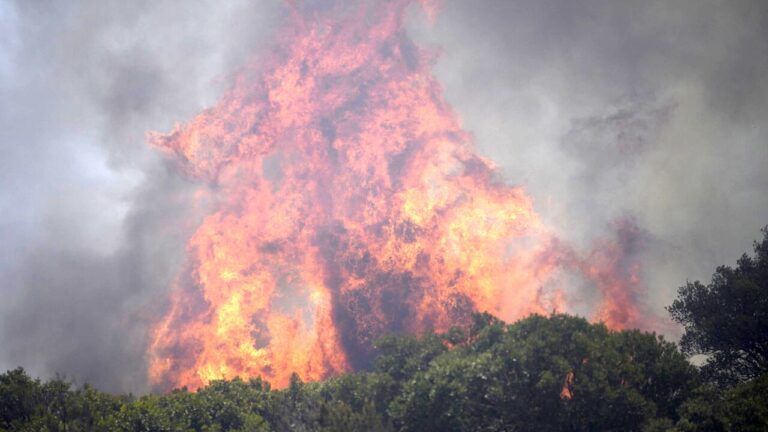
In this hot early summer, France and Spain are grappling with some of the most devastating fires in recent decades. And as if the indomitable fire wasn’t enough, the French firefighters found themselves facing an extreme meteorological phenomenon, practically unknown in our latitudes: pyrocumulonimbus clouds, gigantic storm clouds generated by the smoke and heat raised by the fires, capable of producing strong winds that further fuel the fires and transform the flames into “fire whips”, and lightning that triggers new outbreaks.
How clouds of fire are born
Pyrocumulonimbus clouds arise from hot, turbulent air generated by the heat of a sufficiently large fire. These masses of air and smoke naturally rise towards the highest layers of the atmosphere, where the humidity contained in the air condenses, and leads to the formation of cumulus clouds (i.e. clouds). When the heat generated by the flames reaches critical values, the ascending air column gains vertical thrust, expanding to form the classic anvil structure typical of cumulonimbus clouds, generating powerful winds on the ground, where the void left by the heated air is filled by that coming from the periphery of the fire. Updrafts within these structures can exceed speeds of 150 kilometers per hour, carrying large quantities of ash and moisture to high altitudes where temperatures drop well below freezing.
At those altitudes, water droplets transform into ice crystals, and the continuous collisions between these crystals and suspended ash particles generate electrical charges completely similar to those of conventional thunderstorms. When the accumulated charge exceeds a certain limit, the cloud discharges lightning to the ground. And since the rain produced by the storm often evaporates before reaching the ground due to the temperatures of the underlying dry air layer, lightning falls on vegetation already dried by the heat, giving rise to new secondary fires even several kilometers away from the original front. At the same time, the very powerful winds generated by the pyrocumulonimbus further fuel the fire, and make extinguishing operations extremely dangerous, both on the ground and in the air.
The dangers for rescuers
The rapid rise of the air upwards sucks strong currents from the edges of the fire, while the descending currents can hurl themselves downwards with very violent gusts. This behavior makes the direction of advance of the flames unpredictable, exposing emergency teams to high risks and making traditional containment strategies ineffective.
In several sectors of the Gironde, in fact, rescuers had to abandon the direct attack on the fire to concentrate exclusively on the protection of population centers and on evacuations. The winds are such that they also represent a threat to flying rescue vehicles, which in these cases are forced to abandon direct extinguishing operations, limiting themselves to throwing water and retardants around the perimeter of the fire in an attempt to contain it.
The expansion of the phenomenon
Historically, pyrocumulonimbus clouds are mainly widespread in geographical areas characterized by enormous forests such as the United States, Canada and Australia. In Europe, however, they are a recent presence: the best known was the one developed by the fire in Pedrogao Grande, Portugal, in 2017, but to date they have remained extremely rare. For this reason, the new French episode demonstrates that the conditions for their formation are no longer an occasional event, but risk becoming increasingly common on our continent too, driven by climate change which increases summer temperature and drought records, year after year.
To understand and predict these events, initiatives such as the European Rosetta research project have been launched, aimed at developing simulation models capable of integrating fire dynamics with atmospheric physics. The objective is to ascertain how common pyrocumulonimbus clouds are becoming on European territory, and to provide civil protection services with predictive tools to anticipate the formation of fire clouds and manage the evacuation plans of local populations in time.