
Trees uprooted, roofs torn off, cars damaged, signs torn down and roads suddenly covered in branches. After a violent storm, the first explanation is almost always the same: “A tornado passed.” Very often, however, that definition is wrong. The violence of the gusts and the extent of the damage are not enough to demonstrate the passage of a tornado. In many cases the culprit is a downburst, a mass of air that falls from the storm cloud, reaches the ground and expands rapidly outward.
Tornadoes and downbursts can produce comparable gusts and leave behind very similar scenarios of devastation. However, their dynamics are profoundly different: in a tornado the air rotates around an almost vertical axis, while in a downburst it hits the ground from above and spreads in a divergent way.
When we can really talk about tornadoes
In Italian meteorological language, “trumpet” is normally used as a synonym for tornado on land. A tornado is a rapidly rotating column of air that extends from the base of a thundercloud to the ground.
A supercell is a highly organized and relatively persistent thunderstorm characterized by a rotating updraft. This larger rotation is called a mesocyclone and can be several kilometers in diameter. The tornado, when it develops, is a much smaller circulation within or beneath this structure.
Contrary to what is often thought, it is not essential that there is a funnel perfectly visible from the cloud to the ground. The vortex may already be in contact with the ground even when condensation makes only the upper part visible. Dust, debris, or vegetation swirling at the base can reveal the tornado’s presence even in the absence of a complete cone.
Most of the most intense and destructive tornadoes are associated with supercells. However, there are also tornadoes not linked to a well-organized mesocyclone, such as the so-called landspouts, which can form along lines of convergence under less structured storms.
At the same time, observing shreds of low clouds or chaotic movements under a thunderstorm is not enough to conclude that a tornado is underway. A funnel cloud, that is, a funnel cloud that rotates but does not reach the ground, is not yet a tornado. It becomes such when the circulation comes into contact with the ground, even if the connection is not entirely visible.
What is a downburst
The downburst is born inside a cumulonimbus cloud, the typical cloud of thunderstorms. During the mature phase of the storm cell, a colder, denser air current accelerates downward. The descent can be favored by the weight of precipitation and by the cooling produced by the evaporation of the rain or by the melting and sublimation of the ice particles. When this air mass reaches the ground, it cannot continue to descend and expands rapidly in all directions, like a jet of water hitting a surface.

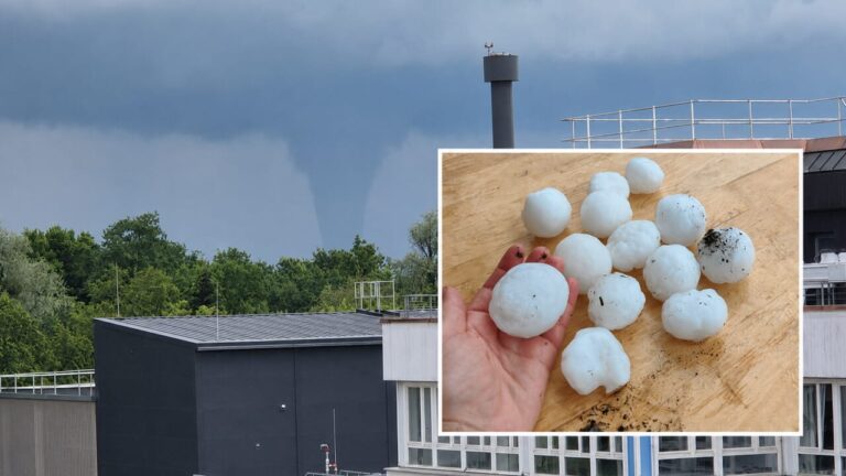
The result is a front of violent and often sudden gusts that hit large areas, even tens of kilometers in diameter. In the most intense downbursts, speeds can exceed 160 kilometers per hour and, in extreme cases, approach or exceed 200. A microburst can be extremely violent and represent a very serious danger, in particular for aircraft during take-off and landing phases, for light structures, for campsites and for those at sea or in tree-lined areas.
There are also “dry” downbursts, in which precipitation can largely evaporate before reaching the ground, and “wet” downbursts, accompanied by intense rain or hail. In Italy and the Mediterranean area many destructive episodes are hidden within rainfall, making it difficult to recognize them with the naked eye.
Because the damage is mistaken for that of a tornado
A violent tornado can reach intensities enormously higher than a downburst and almost completely destroy buildings in its path. But the downburst often has a more extensive footprint. The gusts can simultaneously hit neighborhoods, forests, roads and infrastructures on a front of several kilometers. Even when the wind is less intense than that of a strong tornado, the total surface area exposed can be much greater.
A downburst can topple trees, lift roofs, damage sheds and displace heavy objects. The intensity of the damage alone therefore does not allow us to distinguish the two phenomena. The difference can emerge by observing the arrangement of the debris. In tornadoes, damage tends to be concentrated along a trajectory and may show a converging, rotational or highly irregular component. In a downburst, trees and objects are more often spread out in a similar direction or fanned out, because the wind expands outward from the point of impact.
However, this is not an infallible rule. The presence of buildings, hills, forests and roads can deflect the wind and produce small local vortices. Even a linear storm system can generate descending gusts and brief tornadoes simultaneously.
The shelf cloud is a warning sign, not a tornado
One of the most recognizable signs of the arrival of strong gusts is the shelf cloud. It appears as a low, horizontal, and often arching structure along the advancing edge of the storm. The shelf cloud forms at the gust front, the gust front that separates the cold air exiting the storm from the warmer surrounding air. It may announce very intense wind, but it is not a tornado and does not necessarily indicate the presence of a Tornadic rotation. Shreds of low, ragged clouds, called scud clouds, can also move quickly and take on ominous shapes. They are often mistaken for cloud funnels, but generally do not have an organized rotation.
However, you shouldn’t rely only on sight. A tornado may be shrouded in rain, hidden by darkness, or lacking a fully condensed funnel. Likewise, a wet downburst can come along with a wall of rain that blocks the gust front from being seen.
Linear storm systems and so-called bow echoes, arc radar structures, are among the main culprits of the widespread damage caused by non-tornadic convective bursts. They may also contain multiple downbursts and, occasionally, brief tornadoes.
Waterspouts: they are not all the same
When a rotating column of air develops over the sea or a lake, it is called a waterspout. Even in this case a distinction is necessary. Tornadic waterspouts are associated with intense thunderstorms and have similar dynamics to tornadoes on land. They can produce violent winds, hail, lightning and significant damage to boats.
The so-called “fair weather” waterspouts, on the other hand, generally form in less disturbed conditions, starting near the surface of the water and developing upwards. They are on average smaller and less intense, but should not be considered harmless: they can still capsize small boats, damage factories and become dangerous if they reach the coast.
Does climate change make downbursts more frequent?
Downburst is not a new phenomenon. It has always existed and is a natural component of thunderstorms. But frequency and intensity increase in a warmer climate. Atmospheric warming can increase the amount of available water vapor and, in many regions, the potential energy for convection. Some recent studies identify a growth in environments favorable to severe storms in Europe, with very marked differences between one region and another. Northern Italy and the areas around the Alps are among the European areas most exposed to intense convection.

A high-resolution European climate simulation published in 2025 estimated, under a three-degree global warming scenario, an overall increase of about 11 percent in supercells, accompanied by an intensification of several associated hazards.
How to protect yourself
The rapid development of storms makes it impossible to always establish well in advance the exact point at which the most violent gusts will occur. Weather warnings indicate a risk area, not the precise location where a tree will fall or a downburst will form.
It is always a good idea – when a storm is approaching – to reach a solid building or, failing that, stay inside a car with the windows closed. Trees, parks, scaffolding, gazebos, billboards, temporary structures, piers, beaches and bodies of water should be avoided. Whoever is driving must reduce speed or stop in a safe place, because the lateral gusts can cause vans, caravans and tarpaulin vehicles to skid. At home it is advisable to close windows and shutters, move away from windows and secure objects on balconies and terraces.
Civil Protection also recommends not resuming outdoor activities until at least thirty minutes have passed since the last thunder.
Dossier is the investigations section of The Vermilion. If you want to support our journalistic work and subscribe, visit our showcase by clicking here.